Tuesday, December 15, 2009
Thursday, November 19, 2009
::: Alsace, France :::
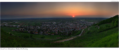
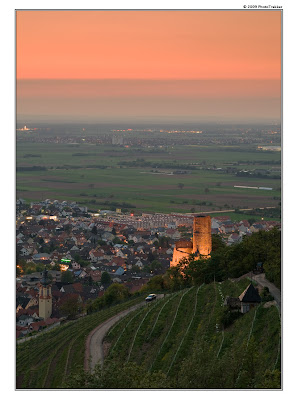
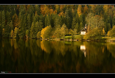
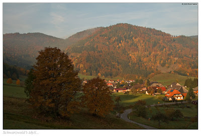
So, few pictures from the are of Munster, a small sleepy town south of Strassburg, seated at the foothills of Vosges Mountains, which are running direction north-south along river Rhein. Their brothers on the east side of the river is famous German Black Forest.
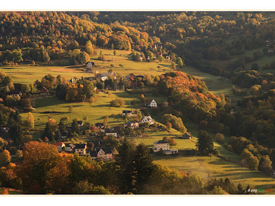
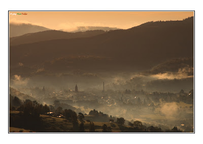 Малко странно, но е факт - отне ми близо 2 години за да почна да проучвам близките райони на Франция, граничещи с Германия - Елсаз и Лотарингия. Две провинции, които от векове са населявани с немскоезично население, но в крайна сметка се озовали в територията на Франция. Колко пoзнато, нали? Нещо като Македония, доскоро част от измислицата Югославия, а сега народът й с промити мозъци - нещо като "независима" държава. Както и да е... По-горе виждате две снимки от първото ми пътуване в района южно от Страсбург - малкото, типично френско градче с типично немско име - Мунстер или Мюнстер (Deutschland über alles -тъй че Мюнстер), или французите знаят как си го произнасят. Разположено е от източната страна на планинската верига Воже, извиваща снага на западния бряг на река Рейн, по подобие на Шварцавалд, отттатък Рейн - в Германия. Един вид, планини близнаци, но не точно. Докато Черната гора е повече иглостен масив, с много малък процент широколистни дървета, при Воже не е така. Което придава особено очарование на планината през есента. Прекосявайки Воже (Vosges) от Мюнстер човек се озовава в Жерармер - едно чудно, малко известно курортно градче, което има толкова швейцарски дух, че не е истина - шалетата (дървените къщи), сравнително високите планини ( Е, не колкото в Швейцария, то няма как иначе), запазанета природа, безбройните водопади и няколкото езера, ски пистите... Но затова в следващия пост.
Thursday, November 12, 2009
::: Trip report - Wildpark Bad Mergertheim :::
 Дремещо полярно лисиче (Vulpes lagopus)
 За жалост е пленник в т.нар. wildpark край Бад Мергертхайм, Баден Вюртемберг. Води се един от най-добрите подобни паркове в Европа. Разликата с обикновен зоопарк е, че животните имат огромни простраства за живот, плюс многожество растения и камънаци наподобяващи естествената им среда. Видимо няма огради (освен при хищниците, но първо имаше ровове). Но все пак... са си в плен.
___________________
This picture of sleeping arctic fox was captured in the wildpark near Bad Mergertheim, a small town in Baden-Württemberg. It was almost 5 o'clock in this overcast day in late October when I saw it few hundred feet away. It seems them 200mm lens is not enough. I was hopping for better portrait shot. The small fuzzy ball had different opinion about it. It was sleeping on that rock at the end of the dwelling, away from annoying tourists with cameras like me :)
 *
*Thursday, October 8, 2009
Wednesday, September 30, 2009
Monday, September 28, 2009
Monday, September 14, 2009
::: The photographer's ephemeris :::
___________________________
Introduction
Landscape photographers typically wish to plan their shoots around the times of sunrise/sunset or twilight, or alternatively when the moon is in a particular place in a particular phase.
While times of sunrise etc. are readily available on various sites on the internet (direction of sunrise etc. less so, but still readily found), there are fewer programs available which combine such information with a topographical map allowing the photographer to match the astronomical to the location.
A typical use might be to determine when the sun will set along the axis of a mountain valley, or when a full moon rise will rise across a lake.
The application uses Google Maps providing users the ability to select a location and determine the time and azimuth of sunrise or sunset for a given date or dates.
So what’s new about this?
Not a huge amount – there are other programs out there that calculate the same data and more.
What I haven’t seen before is the combination of the key data together with a topographical map, courtesy of Google, in one program for either Windows or Mac.
If you’re already on location, this isn’t probably going to help. If you’re planning a trip, then perhaps this is the program for you.
Cost
Nothing. It’s free. Help yourself.
Monday, August 31, 2009
::: Zermatt II :::

The unusual side of the Toblerone - from Klein Matterhorn. Most of the pictures of this emblematic summit are taken towards the photogenic side - east and north-east. 16 vertical shots here, hendheld - from Matterhorn on left and Dent Blanche, Grand Cornier,Triffthorn, Besso to Weisshorn on far right.
___________________________
Нетипичната страна на Тоблерона - тук сниман от Клайн Матерхорн. Преобладаващата част от снимкови материал за Матерхорн е сниман откъм по-фотогеничната му час - източната стена. Панорамата е сглобена от 16 вертикални кадъра, от ръка. От ляво на дясно - Матерхорн, до него в далечината - Дент Бланш, Гран Корние, Трифтхорн, Бесо и в дясно - Вайсхорн.

Friday, August 14, 2009
Wednesday, July 1, 2009
Monday, June 22, 2009
Friday, June 19, 2009
Wednesday, June 17, 2009
Monday, June 15, 2009
::: Grindelwald's icons :::

The Wetterhorn (3,692 m) is a mountain in the Swiss Alps close to the village of Grindelwald. Although it was first climbed in 1844, the ascent by Alfred Wills and party in 1854 is the more celebrated, and is generally regarded to have marked the beginning of the golden age of alpinism.
The mountain is in fact composed of three distinct but close peak: the Wetterhorn (most visible from Grindelwald), the Mittelhorn (highest) and Rosenhorn.
The Schreckhorn (4,078 m) is a mountain in the Bernese Alps. It is the highest peak located entirely in the canton of Berne. The Schreckhorn is the northernmost Alpine four-thousander.
The Eiger is a notable mountain in the Bernese Alps, rising to an elevation of 3,970 m (13,025 ft.) It is the easternmost peak of a ridge-crest that extends to the Mönch at 4,107 m (13,474 ft.), and across the Jungfraujoch to the Jungfrau at 4,158 m (13,641 ft.). The peak is mentioned in records dating back to the 13th century but there is no clear indication of how exactly the peak gained its name. The three mountains of the ridge are commonly referred to as the Virgin (German: Jungfrau, lit. "Young Woman" - translates to "Virgin" or "Maiden"), the Monk (Mönch) and the Ogre (Eiger). The name has been linked to the Greek term akros, meaning "sharp" or "pointed", but more commonly to the German eigen, meaning "characteristic".The Jungfrau is one of the main summits in the Bernese Alps, situated between the cantons of Valais and Berne in Switzerland. Together with the Eiger and Mönch, the Jungfrau forms a massive wall overlooking the Bernese Oberland and considered one of the most emblematic sights of the Swiss Alps.
The construction of the Jungfraujoch railway east to the summit in the early 20th century made the area one of the most frequented places in the Alps. The Aletsch Glacier lying on the south was declared a World Heritage site in 2001.
Saturday, June 13, 2009
::: Giessbachfall :::

This 391m high waterfall is not the highest in the Alps, even not in Europe itself, but definitely the most impressive I've seen. The sound of the dropping water is so impressive that you just forget everything else. You are obsessed, overwhelmed by the power of Mother nature. And at least for a moment feel small and irrelevant.
В Алпите има и по-високи водопади, може би има и по-красиви (които не съм посетил), но този впечатлява с огромното количество падаща вода. А звукът и миризмата на влага около него трябва да се изпита лично. Веднъж усетил силата на природата, човек се чувства различно. Някак незначителен и дребен с жалкия си живот в града. Истината е сред природата.
Friday, June 12, 2009
::: Rapids :::
 One of the rapids of Triberg's waterfall in Schwarzwald, Baden-Wuerttemberg (Germany). The shot is from the summer of 2008.
Снимката е от лятотo на 2008г. Вижда се един от множеството водоскоци, образуващи водапада Триберг, разположен в пазвите на планината Шварцвалд, Германия. Някъде из блога има още една снимка от там. Който му се търси, да си я намери.
Saturday, June 6, 2009
::: Mürrenbachfall, Lauterbrunnen :::

According to locals, the name Lauterbrunnen is a combination of lauter meaning many, and brunnen meaning spring, fountain, or well. However, there is considerable dispute about the meaning of 'lauter', with some translating it as louder and others as clear, bright, or clean.
The river Weisse Lütschine flows through Lauterbrunnen and overflows its banks about once a year. The source of the river comes from melting snow high in the mountains, thus making it a very pure and clean source of water. It is common practice in the camp sites to chill drinks in the water.
Johann Wolfgang von Goethe's poem Gesang der Geister über den Wassern (literal translation: Song of the Spirits above the Waters) was written while he stayed at the parish house near the Staubbach Falls waterfall in Lauterbrunnen. The Lauterbrunnen valley also provided the pictorial model for J. R. R. Tolkien's sketches and watercolors of the fictitious valley of Rivendell, and possibly also the name of the Bruinen river (meaning 'Loudwater') which flowed through it.
Lauterbrunnen lies at the bottom of a hanging or U-shaped valley that extends south and then south-westwards from the village to meet the 8-kilometre-long Lauterbrunnen Wall.
Wednesday, June 3, 2009
::: Oltschibach waterfall :::
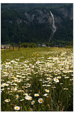
Oltschibachfall plunges about 300 meters down the valley wall. The main plunge of the falls is thought to be in the vicinity of 200 meters itself. Despite what it may look like, the lower part of the falls does drop over bedrock for the most part, though in a few places, it looks like there is some talus. This waterfall is located near village ofUnterbach in Bernese Oberland, Switzerland. Being mountain area in the reagion are more than 70 mostly glacier waterfalls. Most of them in the near by vally of Lauterbrunnen.
Sunday, May 31, 2009
::: Feldberg :::
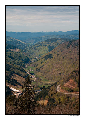
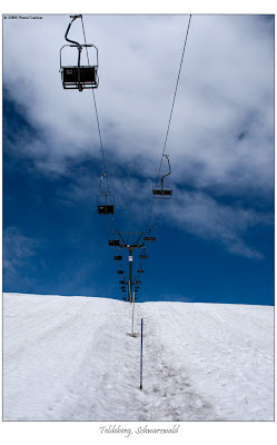
 Some shots from Feldberg ( 1493m) - the highest summit in Hochschwarzwald, southern part of Baden-Württemberg.
Wednesday, May 27, 2009
Tuesday, May 26, 2009
::: Präg :::
 The village of Präg is so small that is hard to find it not even on a route map but in Internet as well (about Präg ). Despite the fact it is a suburb of nearby town of Todtnau it's just 15-20 houses in the typical local style along the road that leads you to Todtmoos - a famous luftkurort in the area.
Saturday, May 16, 2009
Friday, May 8, 2009
Thursday, May 7, 2009
Sunday, May 3, 2009
::: Todtmoos Wasserfälle :::
 Just 20 clicks south of Todnau is the small village of Todtmoos. Through the valley runs small creek. In the nortern part of it is Hintertodmoos (neighborhood of Todtmoos).This is the place I've found this small waterfall. It is just 4-5 m., it is under the shadow of near by Todtnau's waterfall and so less explored and infamous. Located in secluded gorge through a forest and bushy area by the road is easy to miss it if not looking for. The weather forecast this day was for overcast day, which is somehow best for shooting waterfalls but suddenly it became sunny. The area is mountain and dynamic wheather is something normal.
__________________________________________________________
Wednesday, April 29, 2009
::: Todtnauer Wasserfälle :::

My first vertical pano (stitched from 2 frames) shows the Todtnau waterfall which is 97m high. It is located near a suburb of city of Todtnau called Aftersteg in Southern Schwarzwald ( so called Hoch Schwarzwald).
_______________________________________________________________

Thursday, April 23, 2009
Monday, April 20, 2009
::: BASF Town :::

Where river Neckar ( runs through Heidelberg) meets river Rhein is town of Mannheim. On the other side of Rhein is the brother city of Ludwigshafen. It is known for its chemical industry - BASF - the biggest factory is located here. Actually is so huge it is like whole town. On this panorama you see just the northern part of the town. Couldn't take 65 vertical frames to capture it all; There is no such wide angle lens for this industrial monster :)
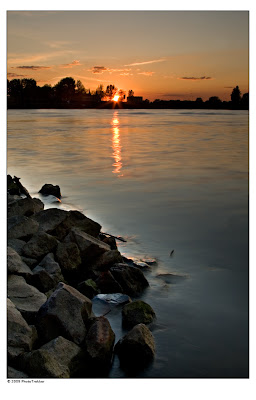 Here is the place where I would like to thank Christian Jahraus, a native from Ludwigshafen for the proposal and guidance. Thanks, Chris.
____________________________________________________________
На водослива на река Некар и река Рейн е разположен град Манхайм. На срещуположния браг на Рейн е града близнак на Манхайм - Лудвигсхафен. Той е известен като града на химическата индустрия. Гигантът-концерн BASF е построил най-големият си завод тук, който е с размерите на град. Разположен е по протежение на река Рейн, и на горната панорамна снимка се вижда само най-северната му част. Тъй като коритото на река Рейн в този район е преправено, на долната снимка се вижда новия Рейн, а от тясно е старото корито. Точно на това място е заснет втория кадър. Между тях се е образувал изкуствено остров наречен Фризенхайм.
Tuesday, April 14, 2009
Wednesday, April 1, 2009
::: Wartberg, Heilbronn :::

Wartberg is 308m hill rising above Heilbronn, Baden-Württemberg. Located in the valley of river Neckar ~144 000 people town is a major industrial and transport center. In the industrial part of Heilbronn is located one of the biggest power plants in this federal state - EnBW Kraftwerk (Energy Baden-Württemberg). North of the city, where river Sulm meets Neckar is town of Neckarsulm (mispronounced as NeckarsUlm). The area is so urbanized that just autobahn A6 splits them. Neckarsulm is famous as city of Audi ( R8 is made here; Quattro GmbH) and LIDL.
____________________________________________________________________
Вартберг е хълм с височина 308 метра, издигащ се на град Хайлброн, Баден-Вюртемберг. Разположен в долината на река Некар, градът с население около 144 хил. души е важен индустриален и транспортен център в района. В индустриалната зона севено от града се намира една от най-големите електрически централи в провинцията. Северно от Хайлброн, там където река Сълм се влива в Некар е градчето Некарсулм. Районът е толкова урбанизиран, че границата между двата града е автомагистрала А6. Некарсулм е известен като централата на "Лидъл" - верига магазини и с фабриките на "Ауди" (тук се произвеждат прочутите Куатро машини и спортната R8).

Tuesday, March 24, 2009
::: Schriesheim, BW :::
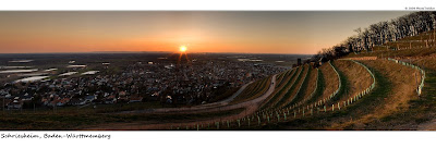
Same place, different time ( of the year). Link to the other entry about Schriesheim, BW.
________________________________________________________________
Мястото е същото, но календарното време е друго. Връзка към предната публикация относно градчето Шрисхайм - тук.
Sunday, March 22, 2009
::: Weinsberg :::

Weinsberg is a small community near Heilbronn, province of Baden-Württemberg. It is located off the intersection between autobahns A6 and A81. The small hill above town (Burgberg) is almost fully covered with vineyards. Being strategic place on top of the hill is a small medieval fortress - Burg Weibertreu.It is build around 1200 A.C, as well as the town bellow. "Weinsberg" comes from the German word for vineyard.
_____________________________________________________________________
Вайнсберг е малъг град в близост до Хайлброн, Баден-Вюртемберг (Германия).Разположен е в непосредствена близост до детелината между автомагистралите А6 и А81 (съответно изток-запад и север-юг). Малкият хълм над града е почти напълно обезлесен и превърнат в лозарски масиви. Поради стратегическото си положение на върха на хълма е разположена средновековна крепост - Вайбертрой (произношението може да е некоректно). Крепостта, както и града са основани около 13 век. Името на града произлиза от немската дума за лозе.


